
Based on the previous four days, it was clear that the real threat from Harvey was going to be the rising water due to torrential rains and less the damaging winds and storm surge. In fact in less than twenty-four hours, Interstate 10 became unrecognizable.

Monitoring Twitter, I began to see tweets from Port Arthur residents begging for rescue.


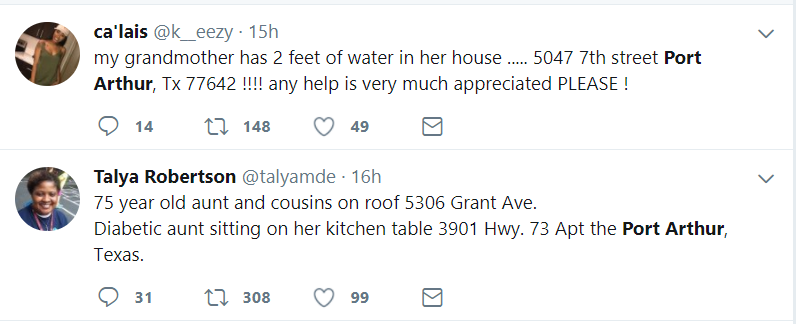


One after the other...I couldn't believe it. It was heartbreaking...in darkness...the elderly unable to escape without assistance....Haley Davis, the expectant mother standing in waist deep water...and snakes...SNAKES!
I had to do something, but in every way powerless to take any real action. My neighborhood was cut-off. All roads to FM 1093 (including FM 1093 itself) were impassable. So I couldn't even leave my neighborhood, much less navigate the hundred plus miles to Port Arthur.
I definitely felt a call to action. True, I could simply re-tweet these as they come across, but a comprehensive view is what was lacking. I needed a way to display these tweets on a map allowing rescuers to hit entire streets or neighborhoods. Yes, a map is what was needed.
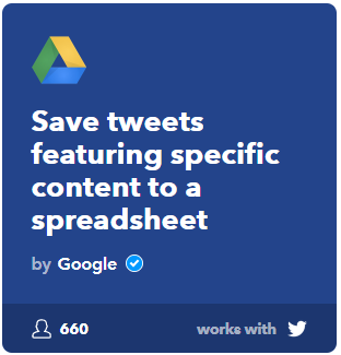 So, I did what any Oracle Nerd would do... I went to IFTTT and found an applet to push Tweets to a Google Sheet that matched the search term "Port Arthur". (For those unfamiliar with IFTTT - IfThisThenThat), it allows you to chain actions together that perhaps otherwise you'd be forced to perform manually.)
Another benefit for me in using IFTTT was that I didn't need to apply for or utilize a Twitter API key. I didn't have time to waste!
Next I ran those results against a regular expression that identified street addresses.
WHERE REGEXP_LIKE (v_string, '\d+ (\w+) (st|dr|blvd|pl|ave|road|rd|court|ct|cir)','i')
Not perfect, but I needed something out in a hurry. Lives were in the balance.
From there, I created a Custom Google Map. No need to geocode the addresses. Google Maps does that automatically.
The results painted a pretty clear picture of what parts of Port Arthur were most in need. I pushed it out to the local authorities and the Cajun Navy

Best of all the Google Map embedded in the tweet is fully functioning. Zoom in. Zoom out. Call-outs are all available as evidenced here

The entire effort took less than an hour.
Pretty geeky? Yeah, but it's what you do when you do what we do.
I have no way of knowing whether my actions contributed to any rescues. I'll probably never know. I do know the rescuers, as a result, were provided better data in which to do their jobs. That's enough for me.
...our journey continues
2 comments:
Bravo Monty,
You could have remained safe and comfortable at home, but you used your special expertise to help. How admirable.
Lloyd Muccio
Congrats for the great job!!
Post a Comment